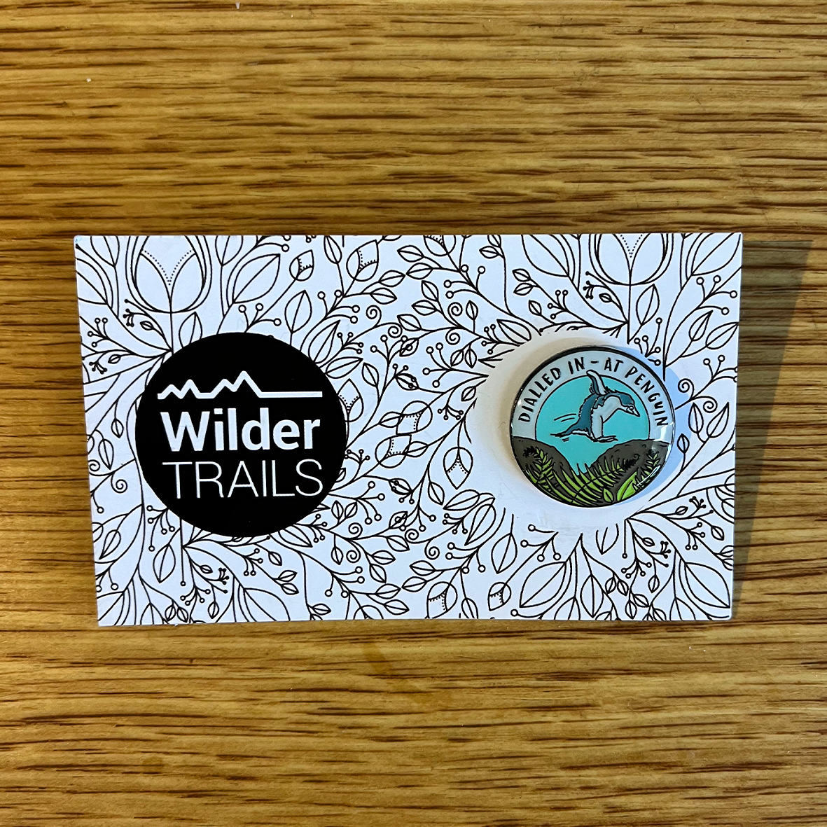
Wilder Trails Pins
At request of our Wilder Trails enthusiasts, we are excited to share a selection of enamel pins representing places from all around Tasmania as well as some custom designs made... Read more
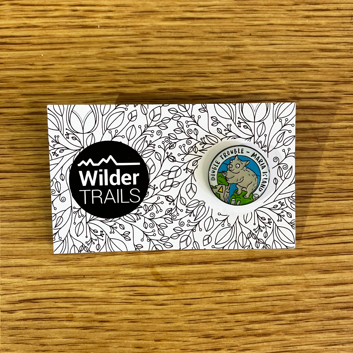
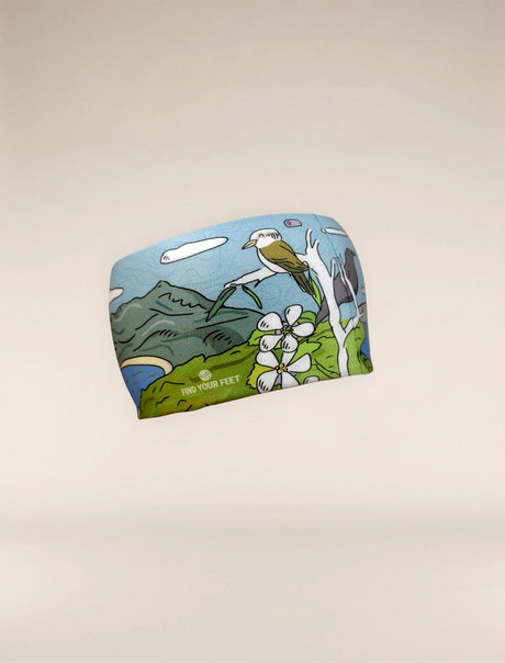
Wilder Trails Pins - Double Trouble - Maria Island
Pickup currently unavailable at Find Your Feet Hobart
Description
Description
At request of our Wilder Trails enthusiasts, we are excited to share a selection of enamel pins representing places from all around Tasmania as well as some custom designs made by us!
Route Info
Double Trouble - Maria Island
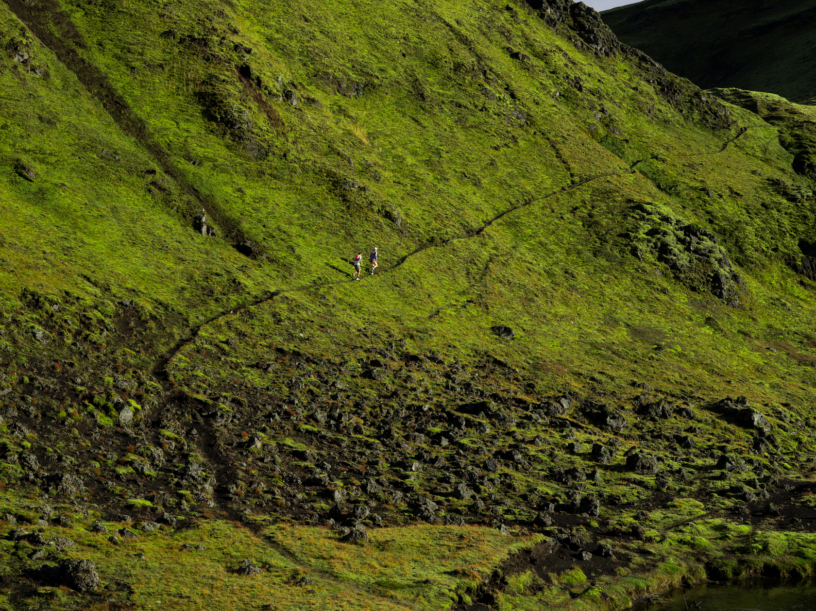
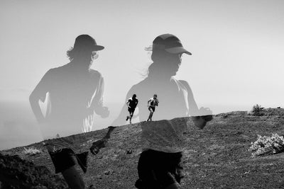
Maria Island is a truly unique place. It provides the ideal combination of diverse trails, wide open spaces to roam freely, nature, history and that sensation of being on a remote island paradise. It rewards those who seek to explore wilder! Our route has been created to showcase Maria Island's best gems - the summits of Mt Maria and Bishop & Clerk, Painted Cliffs, Fossil Cliffs, views to Freycinet in the north and sweeping vistas to the isthmus in the south. Before and after your adventure you will be able to swim in blue coves, walk barefoot on the sandy beaches and explore the layered history of the Darlington Probation Station – a World Heritage Australian Convict Site. During this adventure you really will leave your ordinary life behind.
The geography of Maria Island is remarkable. Spectacular cliffs wrap around the eastern side of the Island, providing a perfect vantage point for watching birds dive and swoop into the ocean. In season, you may even be lucky enough to spot the whales that frequent these waters during their annual migration. On the western side of the island, the Painted Cliffs are one of Maria Island’s more memorable spectacles, showcasing the power of nature in their weathered contours, where the combination of wind and waves has eroded the sandstone to reveal a striking façade. It is great to get to the Painted Cliffs at low tide and even better, at sunset when the western rays make the cliff's colours glow brightest.
The route begins in the Darlington historic precinct and then climbs to the summit of Bishop & Clerk via the Fossil Cliff tops. It returns the same way before taking a detour via the lower slopes of the Fossil Cliffs where you can browse amongst the rocks for fossils. From here you can return to Darlington for a rest and to refill your supplies, before heading towards Mt Maria via the Oast House, a quiet nook of the island. From the summit of Mt Maria you will catch remarkable views to the southern isthmus of the island, as well as mainland Tasmania. Returning from Mt Maria your final stop will be the Painted Cliffs. Hopefully you will arrive at low tide and be rewarded with the ability to hop carefully under the cliffs to catch their full beauty. The final stretch will be back along Hopgrounds Beach and then over the hill to Darlington for a well-earned swim! We highly recommend staying longer on the island as the camping is beautifully created amongst the native trees and wombat grazing lawns. You can also choose to stay overnight in the basic penitentiary, a great experience for the whole family. Be prepared to be overawed by the splendour of Maria Island and our Double Trouble route!
Route Highlights:
- Test your mountain fitness on both Bishop & Clerk and Mt Maria, two rocky alpine peaks towering over the Tasman Sea.
- Spot whales and sea eagles from their summits.
- Immerse yourself in the history of Maria Island and finish the day at Darlington, a World Heritage Area thanks to its rich convict & European histories.
- See the day's changing colours at the famous Painted Cliffs.
- Find yourself endeared with the island's wildlife, including the wombats, Cape Barren Geese, pademelons, wallabies and rare Forty-spotted Pardalotes.
|
Difficulty
|
Level 3, Performing Wilder
|
|
Distance
|
29.7km
|
|
Ascent
|
1727m
|
|
Descent
|
1727m
|
|
Terrain
|
From sandy beaches, smooth grassy plains, fire trails and gentle single tracks to rocky, alpine terrain with many small & large boulders. There are some short sections with rock scrambles, especially on Bishop & Clerk. The terrain is varied but should not be underestimated on the mountain peaks.
|
|
Approx. Duration
|
6-8hrs
|
|
GPX File
|
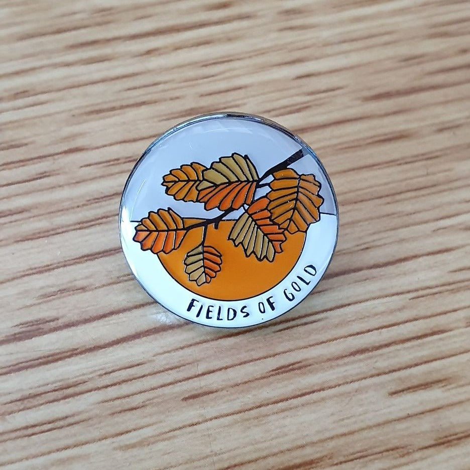
Fields Of Gold
This route begins at the Lake Dobson Carpark at the top of the Lake Dobson Road. This is only accessibly by private vehicle. The route traverses this loop in an anticlockwise direction, initially passing Lake Dobson on the Lake Dobson Track, a well groomed fire trail, before turning right and heading down the valley on the Lake Webster Track past Lake Seal. After passing Lake Webster the track then climbs gradually but continuously up to Tarn Shelf and the famous Twilight Tarn Hut. In Autumn this region is a paradise for photographers. After pausing the gather your breath you will then meander back along Tarn Shelf past numerous small lakes and tarns. This will be a highlight of the trail as you gaze up to the Rodway Range (1377m). This range is also covered in expansive fields of Northofagus whilst the tarns provide a magical swimming experience, especially when the red and gold leaves lazily float on the water's surface. After reaching the far end of Tarn Shelf and the Mt Field Ski Area, you will descend quickly down a large fire trail back to the Lake Dobson Carpark. If you are brave, Lake Dobson also provides a refreshing swimming experience after your day on the trail!
Whilst this route is magical at many times of the year, Autumn is especially rewarding for the rich blaze of colour here in the mountains. Winter can be a very problematic time due to substantial snow and ice cover and we strongly discourage participants from venturing here during that time of year. Summer and Spring are both glorious too with many plants flowering and adding colour & perfume to the day. Just be wary of snakes during peak summer!
We hope you will enjoy some of our other Wilder Trails soon!
More information on this route can be found here:
https://www.wildertrails.com.au/mountfield.html
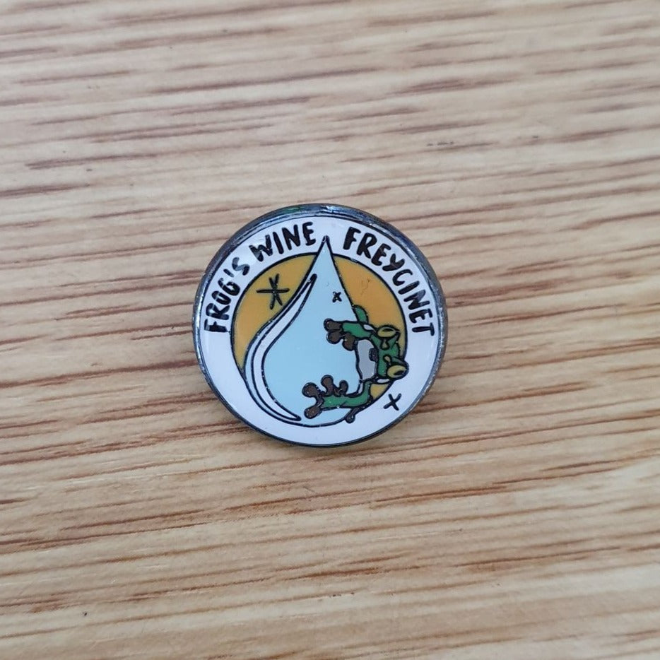
Frog's Wine Freycinet
This route is inspired by Hanny's early family camping experiences to the Freycinet Peninsula. On this route you will first explore the rises and falls of the undulating coastal trail from the Wineglass Bay Track to Hazards Beach, where you will likely then find yourself meandering up a shell-strewn beach with distant views to Mt Freycinet, Mt Graham and the rest of the peninsula beyond. As you cross the isthmus towards Wineglass Bay, we ask you to pause at the vast inland lagoon, marvelling at the chorus of frogs, deliriously drunk on their frogs' wine. If you are quiet and sneaky you can often find the frogs galloping near the water's edge. After leaving the lagoon you will then visit Wineglass Bay and whilst not compulsory we will offer extra bonus high-fives to those who brave a swim in her chilly waters! Finally lean into the climb back to Wineglass Bay lookout and marvel at just how far you have come and the beauty of the Peninsula now laid out below you. Then whoop, whoop, whoop all the way back down the hill to the carpark. Just magical!
Route Highlights:
- Meander on shell-strewn Hazards Beach.
- Search for frogs and listen to their chorus at the majestic Hazards lagoon.
- Take a dip in Wineglass Bay, the Park's most famous jewel... albeit a cold one!
- Surprise yourself on the climb to Wineglass Bay and pat yourself on the back as you reflect on just how far you have come.
- Whoop, whoop, whoop all the way back down the hill to the carpark!
For more information visit:
https://www.wildertrails.com.au/frogs-wine-loop.html
|
Difficulty
|
Level 1, Growing Wilder
|
|
Distance
|
11.5km
|
|
Ascent
|
430m
|
|
Descent
|
430m
|
|
Terrain
|
Smooth gravel footpaths to undulating, rockier granite trails. Steep stone stairs to white sandy beaches. The route is varied but accessible to most trail enthusiasts. Minimal trail experience is required.
|
|
Approx. Duration
|
1.5 - 3hrs
|
Jerusalem's Calling
Once a secret shrouded in nomenclature mystery, today The Walls of Jerusalem is an iconic National Park nestled into Tasmania's World Heritage Area. Famous for its ancient stands of Pencil Pines at Dixons Kingdom and dolerite amphitheatres, this landscape will literally take your breath away!
The route begins at The Walls of Jerusalem carpark located in the Mersey Valley and climbs steadily up to Trappers Hut, one of the few remaining standing snarer’s huts in the Mersey High Country. After this long climb through tall Eucalyptus forest, you reach the plateau where a meandering trail takes you from tarn to tarn, Pencil Pine cluster to Pencil Pine cluster. All the while the peaks of The Walls of Jerusalem come closer and beckon your curiosity. After the Wild Dog Creek campsite a short climb passes you through Herods Gate and into the Central Walls itself. Vistas of majestic Lakes and towering mountains confront you as you make your way through Damascus Gate to Dixsons Kingdom, famous for its ancient Pencil Pine forests. Turning left at Dixsons Kingdom Hut, with its original shingle roof, you will make your way towards Mt Jerusalem where a gentle, steady climb leads you to the summit with views into the central plateau's plethora of lakes and tarns, as well as back to Solomons Throne, The Temple and Cradle Mountain in the distance. Wow! You will return via the same route.
Overview:
Difficulty Level 3, Performing Wilder
Distance 23.9km
Ascent 1111m
Descent 1111m
Terrain Rocky, technical alpine terrain with some sections of boardwalk, smoother trails and open alpine grass meadows.
Approx. Duration 4 - 6hrs
Route Highlights:
- The sensation of timelessness amongst an ancient landscape.
- Marvel at the Pencil Pine stands and forests, an endangered species easily destroyed by fire.
- Admire & shelter in old trapper's huts with their shingle roofs and original internal settings.
- Feel your toes tingle as you peer into a landscape of endless lakes and tarns from the summit of Mt Jerusalem.
- Take optional side trips up The Temple and Solomons Throne, two spectacular mountains with greater vistas towards the Cradle Mountain-Lake St Clair National Park.
www.wildertrails.com.au/jerusalemscalling.html
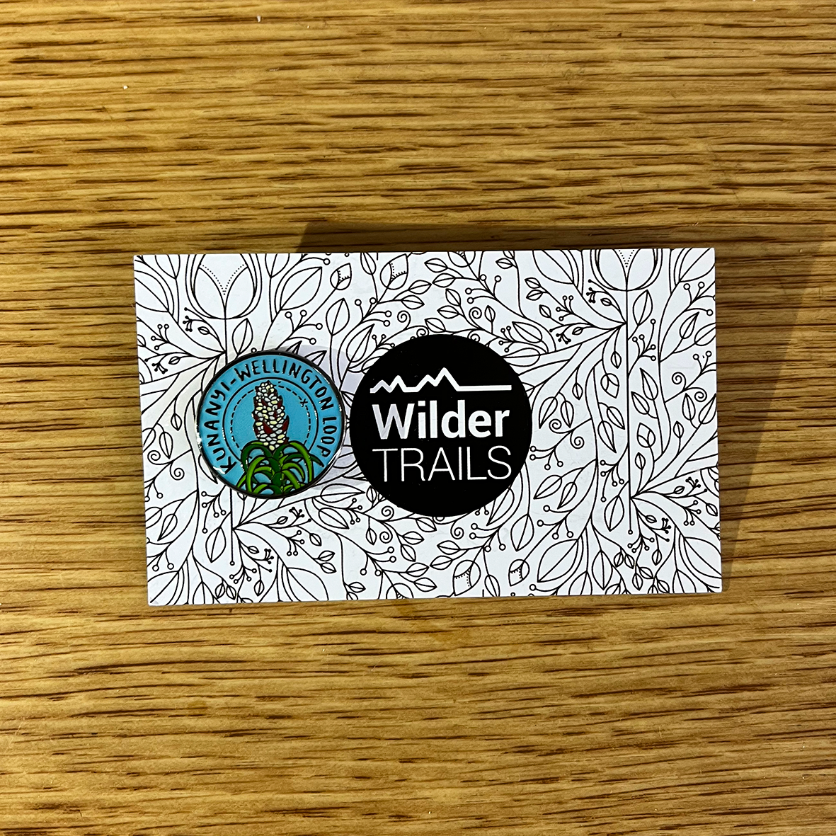
kunanyi-Wellington Loop
Legend! Well done! You are coming to collect your kunanyi-Wellington Loop reward and we hope you had a wildly playful day on the kunanyi trails. Former Tasmanian resident, Jahn Pahwa instigated this kunanyi-Wellington Loop back in 2016. Thanks to Jahn's support and generosity, this 24.5km route was incorporated into our Wilder Trails community project so that people such as yourself could enjoy the mountain challenge. Please proudly show off this badge and tell all your friends, family and trail community to give the kunanyi-Wellington Loop a try. We hope you will enjoy some of our other Wilder Trails soon!
Route Highlights:
- Start & finish in Hobart, taking in the Cascades Female Factory & Cascade Brewery historical sites.
- Visit the beautiful stone Junction Cabin on your way to the Pinnacle of kunanyi.
- Take in breathtaking views of Hobart & SE Tasmania from the Pinnacle, the highest point of kunanyi.
- Then it is all downhill on the way home!
|
Difficulty
|
Level 2, Playing Wilder
|
|
Distance
|
24.5km
|
|
Ascent
|
1280m
|
|
Descent
|
1280m
|
|
Terrain
|
Smooth gravel footpaths to steep, technical mountain trails. The route includes 2 very short sections of asphalt road. Trail experience is required.
|
|
Approx. Duration
|
3.5 - 5.5hrs
|
|
|
START
|
FINISH
|
|
Toliets
|
No - first toilet is approx. 2km up Hobart Rivulet Track at Cascade Gardens
|
No - last toilet is approx. 2km up Hobart Rivulet Track at Cascade Gardens or in Centerpoint Arcade off Collins Street
|
|
Water
|
No
|
No
|
|
Parking
|
No. The carpark at the start of the Hobart Rivulet Track is private use only. We suggest parking in a Hobart CBD multistory carpark or South Hobart and walking to the start location.
|
Same
|
|
Services
|
Hamlet Cafe is located at the start & finish location. Hobart CBD is a 500m walk & South Hobart shopping strip is an 800m walk.
|
Same
|
|
Phone coverage
|
Telstra, Optus & Vodafone
|
Same
|
- Begin at the start of the Hobart Rivulet Track off Mole Street.
- Hobart Rivulet Track to Cascades Female Factory & then the Cascade Brewery
- Cascade Trail to the junction with Main Fire Trail
- Myrtle Gully Walking Trail to Junction Cabin
- Hunters Track from Junction Cabin to the Chalet on the Pinnacle Road
- Pinnacle Road to the Panorama Track (exits from your left just prior to reaching Big Bend on the Pinnacle Road) (please beware of vehicles!)
- Panorama Track to re-meet the Pinnacle Road
- Pinnacle Road to the Summit (please beware of vehicles!)
- Zig Zag Track to the Springs
- We then recommend enjoying a cuppa at the Lost Freight Cafe!
- Lenah Valley Track from the Springs to Junction Cabin (highly recommend stopping at Sphinx Road on your RHS)
- Myrtle Gully Walking Track from Junction Cabin to Main Fire Trail
- Cascade Trail from Main Fire Trail to Cascade Brewery
- Cascade Brewery to Mole Street via the Hobart Rivulet Track.
- We then recommend enjoying a bite to eat at our friends at Hamlet Cafe!
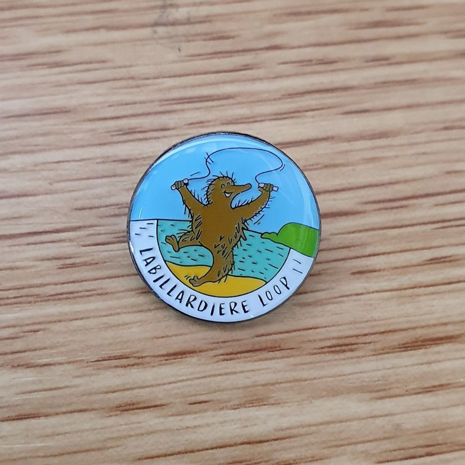
Labillardiere Loop
- Absorb huge views down to the Southern Ocean, Tasmania's south-west mountains & the d'Entrecasteaux Channel.
- Watch the southern swells pound on rocky shores, then later bask in the stillness of the inland coves.
- Keep an eager eye for echidnas, dolphins, and the plethora of Tiger Snakes in summer (we recommend running this route early in the morning if completing this in summer!)
- Be prepared for an urgency to swim in each shallow cove on the way home, finishing at the ideallic Jetty Beach.
- Afterwards, enjoy a picnic be the beach and then meander back up Bruny Island to catch the ferry home. Whether you take your tent and camp out before or after, or simply do this as a day trip, you will love the Labillardiere Loop!
https://www.wildertrails.com.au/labillardiereloop.html
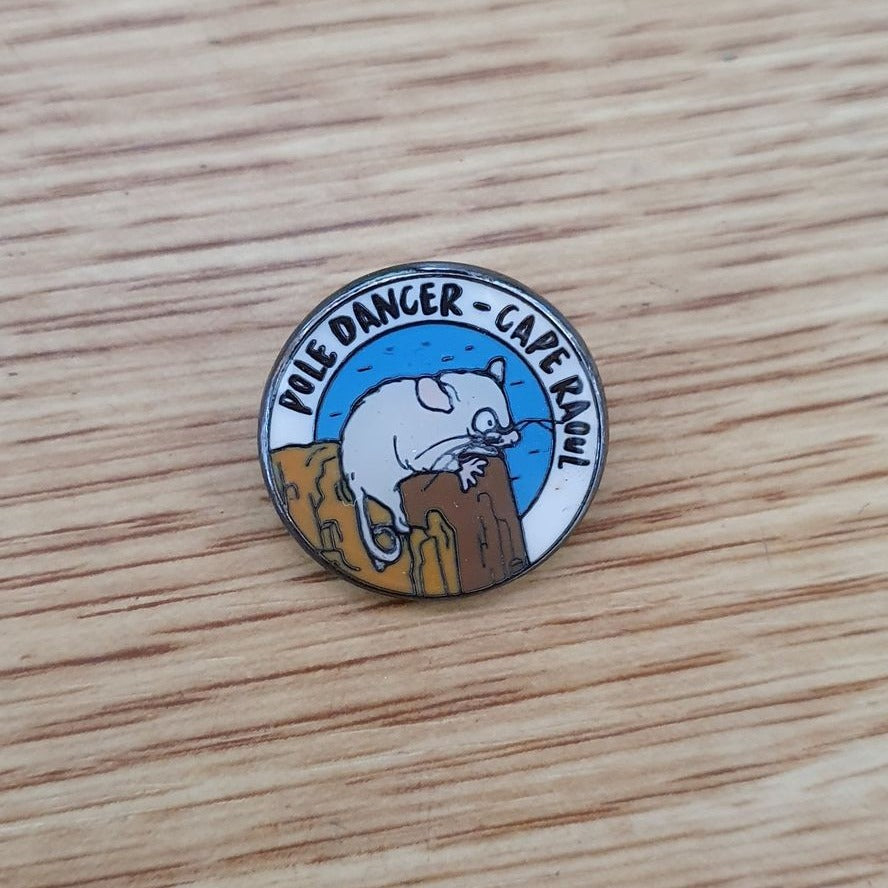
Pole Dancer - Cape Raoul
The Tasman Peninsula has an absolute abundance of dolerite and is a revered region for rock climbing amongst vertical terrain enthusiasts. Perhaps one of the most classic climbs on the peninsula is called 'Pole Dancer', a vertical pillar of dolerite at the tip of Cape Raoul. As the sea swirls below, and whilst the seals bark their encouragement, the climber can feel precariously joyful as he ascends, dancing up the climb. Hence we introduce to you... Pole Dancer!
The route begins in the Cape Raoul carpark at the end of Stormlea Road and follows a very smooth, well graded track to the end of Cape Raoul. At 15.5km in length, this out-and-back route is littered with remarkable view points, jaw dropping plunges to the turbulent seas below, and nooks out of the wind to simply be still, quiet and joy-filled.
Route Highlights:
- Marvel at some of Australia's highest sea cliffs.
- Listen to seals barking and chorusing at Seal Lookout near the Cape's tip.
- Feel awe-inspired as you take in the jagged cape, realising that climbers ascend and descend the pillars above turbulent seas.
- Enjoy the variety of weather-stunted, coastal vegetation which flowers profusely in later winter & spring.
- Feel free to take a side trip to Shipstern Bluff and Tunnel Bay, a hot spot for big wave surfing.
For more information on this route, please visit:
https://www.wildertrails.com.au/pole-dancer.html
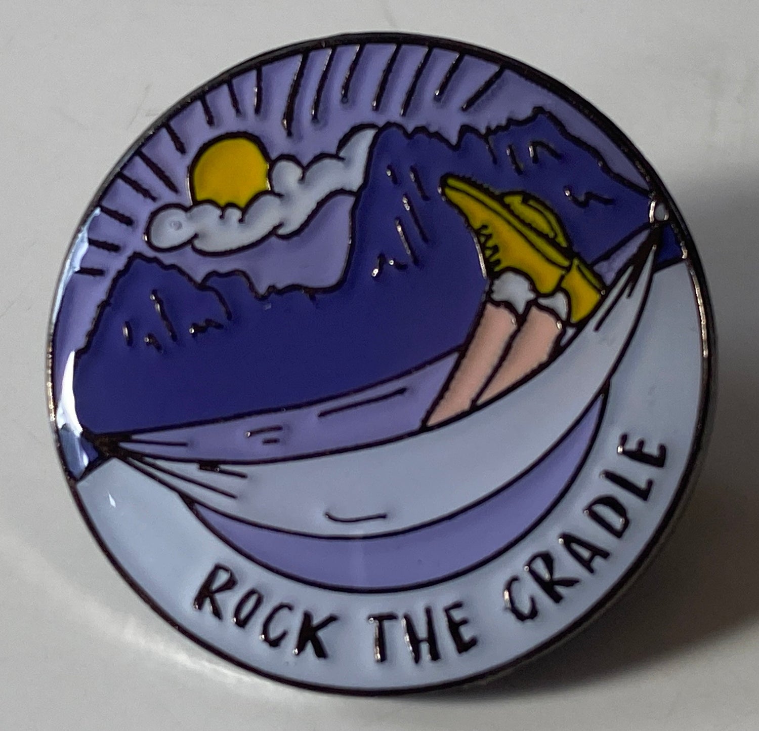
Rock The Cradle
Cradle Mountain is home to some of the most diverse and outstanding landscapes in Tasmania. From dolerite boulder fields to cool temperate rainforest, Alpine eucalypts to button grass moorlands, this region is remarkable. We have seen grown men cry with joy and wonderment as they ran beneath the King Billy Pines at Dove Lake, and other individuals beckoned to 'drop their daks' to dart into the freezing, still waters of Crater Lake. During the route setting of Rock the Cradle we constantly jostled between wanting to look at the views of the mountain's escarpment, and needing to look at where our feet were going as we moved over the rough, uneven terrain. We promise you that this route will steal your breath away, have your neck aching from the constant peering upwards, and make you wish that you were a wombat living permanently beneath the mountains!
The route begins in the Ronney Creek carpark on the Dove Lake Road and is best accessible with the free shuttle bus service from the Cradle Mountain Visitor Centre. The route follows the famous Overland Track up past Marion's Lookout and kitchen hut, before heading south into the Reserve. After traversing under Cradle Mountain's western face, we then take a left-hand turn towards Lake Rodway, a trail which weaves you down into the valley and the old hiker's hut here. From the lake there is a slow, gentle climb back up the incredibly beautiful Artist's Pool to meet the Face Track where expansive views of Dove Lake await you. We return via Hanson's Peak, descending down to Dove Lake and meandering back to Ronney Creek past Lake Lila, a photographer's hotspot. At 20km in length, this large circular route is littered with remarkable viewpoints, neck-creaking views up to the mountain skylines, small alpine Tarns and lakes that beckon you into their frigid waters. Be prepared to be blown away by Rock the Cradle!
Oh, and if you are free in Autumn, especially in the week’s proceeding Anzac Day, we strongly recommend you grab your trail shoes and head for Cradle Mountain. This route showcases some of the most outstanding stands of Northofagus gunnii in Tasmania. This is Australia’s only deciduous plant and grows at a narrow altitude band in Tasmania’s mountains. In the earlier weeks of April, the leaves of the Fagus turn a brilliant display of yellow, orange and red, lighting up the mountain slopes. Some parts of this route literally tunnel through the Fagus, creating an ethereal effect and something every mountain enthusiast must see at least once in their lifetime!
Route Highlights:
- Absorb vast vistas of Cradle Mountain and Dove Lake from Marion's Lookout on the famous Overland Track.
- Dance across rocky terrain as you traverse under Cradle Mountain, gazing out to Barn Bluff in the distance as you weave your way.
- Admire & shelter in old hiker's huts such as Kitchen's Hut, Scott-Kilvert and Rangers Hut.
- Feel captivated as you take in the jagged spires of the Cradle Mountain & Little Horn skyline.
- In Autumn this trail is remarkable for its rich autumn colours when Australia's only deciduous plant, the Arctic Beech (Northofagus gunnii) makes the mountain glow red.
For more information, head to:
www.wildertrails.com.au/rockthecradlemountain.html
Rocky Cape
Rocky Cape National Park is a geographically stunning coastal landscape located on Tasmania’s North West Coast. It is dually named pinmatik / Rocky Cape in acknowledgement and recognition of the ongoing preservation of its Aboriginal culture and heritage.
This ancient coastline offers an extensive display of cliffs and beaches housing vast cave shelters, midden piles and powerful and dominant rock formations.
The floral display along the coastal Sisters Hills is vibrant and diverse. Sightings of Wombat, Quoll, Eagles, Wallabies and Echidna are not uncommon.
Overview
Difficulty Level 3, Performing Wilder
Duration 4–8 hrs
Distance 20.5km
Ascent/Descent 1260m
Terrain Some Fire Trails but almost entirely rocky, undulating walking tracks or boulders. A head for heights and experience with exposed, possibly cold and windy mountain trails is mandatory.
Start and Finish Facilities
Toilets
Yes – at Sisters Beach.
Phone coverage
Telstra, Vodafone & Optus reception. Patchy in areas.
Water
Only at Sisters Beach.
Services
A small General Store is located at Sisters Beach
Parking
Yes.
The Route
-
With ample parking at the Sisters Beach West car park, your journey begins with a short traverse along the beach past the Sister’s Beach Boat Ramp.
-
Signage directs you up a steep single track, passing seaward facing Wet Cave and the Lee Archer Cave turn off.
-
Experiencing the numerous, well signed, side trips will not disappoint, immediately transporting you back thousands of years with Aboriginal caves and often visible midden piles. *
-
A right turn at the signed junction (1km mark) leads you through a dense grove of mature Banksia Trees towards Anniversary Bay. You will be met with breath-taking views as you descend a rocky single track onto the sandy beach.
-
Making your way across Anniversary Bay towards Anniversary Point is made easier on a lower tide, an early start rewarding you with a memorable sunrise across the Bass Straight.
-
From soft sand to coastal heath, Anniversary Point Track leads you up a steep ascent passing by the Doone Falls junction to the Rocky Cape turn-off.
-
Turning Right towards Rocky Cape, this single track takes you on an undulating traverse across the beautiful Sisters Hills to your destination point, Tinkers Look-out. This will be the highest point of your journey (10km mark) and your turn around point.
- Simply follow the same route back to Sisters Beach, passing by the Anniversary Bay turn-off. A steep climb takes you cross Broadview Hill, then descending to your starting point, Sisters Beach West Car Park.
More information can be found HERE
Rufus' Shadow
The Cradle Mountain - Lake St Clair National Park, located deep in the Southwest Wilderness World Heritage Area, is home to some of the most diverse and spectacular landscapes in Tasmania.
The route begins at the Lake St Clair Visitor Centre, a concluding point for the famous Overland Track. From here you will gradually climb up a narrow, rocky trail into the heavens and onto the Mt Rufus plateau. Views await! Looking south you will see endless mountains in the Southwest Wilderness World Heritage Area, and then looking north-west you will be amazed by the landscape heralding The Overland Track region. Lake St Clair will lie a long way below you now! The descent takes you through unusual sandstone pagoda outcrops before reaching the plains that lead towards Shadow Lake. This is a fantastic spot for a VERY refreshing swim! Then homeward bound via The Water's Meet, a juncture of freshly flowing streams, and then the shores of Lake St Clair where another cold dip awaits! Congratulations!
Route Highlights:
- Absorb vast vistas into the Cradle Mountain-Lake St Clair National Park, and south to the Southwest Wilderness World Heritage Area
- Dance across rocky terrain as you clamber to the summit of Mt Rufus.
- Marvel at the unusual sandstone pagodas on the descent from Mt Rufus' summit.
- Duck and weave through the pandandi forest towards Shadow Lake.
- Enjoy multiple swims at Shadow Lake and Lake St Clair as you conclude your day!
www.wildertrails.com.au/mtrufus.html
Snakes & Ladders
The geodiversity of the Wellington Range provides the physical foundation for the landscape, ecosystems and character of Wellington Park and rationale for selecting this exciting route.
Vistas down Snake Plains; a majestic river crossing; a steep climb to Cathedral Rock; ups and downs on the Montagu Thumbs; leaping Wellington Falls; and the finale - rock hopping the Potato Fields.
Overview
Difficulty Level 3, Performing Wilder
Duration 4–8 hrs
Distance 20.5km
Ascent/Descent 1260m
Terrain Some Fire Trails but almost entirely rocky, undulating walking tracks or boulders. A head for heights and experience with exposed, possibly cold and windy mountain trails is mandatory.
Start and Finish Facilities
Toilets
Yes, at The Springs
Water
Untreated water at The Springs with mountain fresh water available at the two river crossings
Parking
Yes. All day parking is available within 200m of the route start location.
Services
“Lost Freight Cafe” on-site drinks, eats and sweets. 9:00am to 3:30pm, 7 days a week
Phone coverage
Telstra, Optus & Vodafone.
The Route
- Check the map at The Springs to locate your start at Milles Track. After 2.5km turn left (South) down the Snake Plains Track.
- Follow for 2.8km (5.3km) turning right onto the Pipeline Track for 1.4km (6.7km) to a fire trail on the left to the NW Bay River.
- Zig Zag down for 0.8km (7.5km) looking for cairns marking the river entry and exit. On exit look for a meandering foot track.
- Turn right at the Betts Road to Cathedral Rock Track, then zig zag up to a steep climb onto Cathedral Rock at 884m ASL.
- Stay mostly high on the ridgeline to navigate the Montagu Thumbs dropping left from time to time.
- After crossing the last of the “Thumbs” the track will be narrow and scrubby but eventually breaks out into a vague fire trail.
- At 13.0km turn right to the spectacular Wellington Falls. Note: Straight ahead goes to Big Bend via Thark Ridge (6.0km).
- Follow route marked with rock cairns for 1km. The final 100m drops steeply to the River above the Falls. Check river height!
- After crossing take the first “Wellington Falls Track” that climbs steeply to the left. At this point you could also consider a quick in/out visit to the Falls Lookout.
- Back on route, go up through forest, flattening out in marshy ground and forest then across the famous “Potato Fields”.
- Look out for the “Disappearing Tarn” (Pseudo-karst Depression) before continuing to The Springs via the Milles Track.
Mapping & directions for this route
- We have created 4 easy ways for you to choose from to safely and enjoyably navigate your way around this route. From a physical map to the more technology savvy, we have your safety at heart!
- Printable PDF directions and map (FREE!)
- Digitally interactive map for use on your smart phone via the Avenza Maps app (FREE!)
- GPX file for upload to your GPS watch (FREE!)
The Honeymoon
Freycinet National Park is home to dramatic pink granite peaks, secluded bays, white sandy beaches and abundant birdlife. Situated on Tasmania's beautiful east coast, the park occupies most of the Freycinet Peninsula and looks out to the Tasman Sea from the eastern side and back towards the Tasmanian coastline from the west.
This route is inspired by an existing, well-known trail run hosted on the Freycinet Peninsula each year. However, our route begins at the majestic Honeymoon Bay and departs on the new shared-use track to the Wineglass Bay Carpark. From here you will pick up the Freycinet National Park's iconic trails, first following the rolling coastal trail to Hazard's Beach, all the while enjoying views back to 'mainland Tasmania'. After a shell-fossicking jaunt along the beach you will pick up the trail to Cook's Beach with its blue, blue waters that is idyllic for a swim! Now the big effort begins with a long, at times very steep climb to the Mt Freycinet/Mt Graham saddle, then to the top of Mt Graham itself. Then down, down, down, down to the world-famous Wineglass Bay campsite and beach for yet another refreshing dip. The route will take you along the soft sands of Wineglass Bay then up and over the lookout track where views back to Mt Graham and the beach await you. Afterwards, enjoy a flowing descent and many high-fives with other walkers to the Wineglass Bay carpark, before picking up the shared-use track back to Honeymoon Bay. The route concludes at Honeymoon Bay where another swim and relaxation period on the granite outcrops will reward you for your efforts. What a trail honeymoon!
Overview
Difficulty Level 3, Performing Wilder
Distance 34.5km
Ascent 1340m
Descent 1340m
Terrain Combined coastal and mountainous terrain with steep climbs and uneven single trails. There is some beach running and short sections crossing granite outcrops too.
Approx. Duration 4-6hrs
Important Information: It is essential that you follow our route recommendations and enjoy this circuit in an anti-clockwise direction from the Wineglass Bay carpark, down the western side of the peninsula. This helps minimise the spread of Phytophthora (root rot).
Route Highlights:
- Duck and weave along smooth flowing coastal trails.
- Meditate and fossick for shells on white quartz beaches.
- Grit your teeth as your ascend rocky slopes with vast vistas on the Mt Graham climb... then whoop all the way down for a crystal-water swim at Cooks Beach.
- Float in turquoise waters surrounded by brilliant red rocks and white sandy beaches.
- Get sand between your toes on the world-famous Wineglass Bay.
- Conclude your day at picturesque Honeymoon Bay where yet another swim awaits you!
www.wildertrails.com.au/thehoneymoon.html
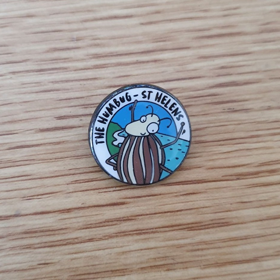
The Humbug - St Helens
Humbug Point is located just a short drive to the north-east of St Helens and marks the beginning of the Bay of Fires. A region rich in biodiversity, spectacular coastlines and smoothly meandering trails, we feel it is one of the undiscovered trail running gems of Tasmania.
The Humbug route begins in Binalong Bay and follows a weaving coastline trail to Dora Point and the gaping mouth of George's Bay, a narrow inlet which opens into the frequently roaring Tasman Sea. From here you will pass through the Dora Point campground to meet the loop trail around Humbug Point, traversing the loop in an anticlockwise direction. The loop first takes you over an open, dry sclerophyll forested hill to Moulting Bay where pelicans and water birds rest in the calm shallows. The return to Dora Point traverses the coastline to Humbug Point and then through spectacular grass tree forests whilst the distant ocean beaches may be roaring on a wilder day. The final leg of this route retraces your earlier steps from Dora Point to Binalong Bay via the coastal trail, once again passing Grants & Skeleton Point. From these points you will catch glimpes of the northern Bay of Fires, with their white sands and blue water calling to you. After completion of this route you will be able to enjoy a refreshing swim in the pristine blue waters of Binalong Bay, followed by refreshments at the local cafe. This really is a spectacular place and we hope that you love this route as much as we do!
We wondered how this area got it’s current name. According to the Tasmanian Nomenclature Board, the regions earliest mentions are of 'Point Puzzle', named by a gentleman called J. H. Wedge, a frustrated farmer who suspected Thylacines of raiding his sheep and lambs. However, the term 'Humbug' is an exclamation pertaining to "nonsense or gibberish". So how Point Puzzle became known as Humbug Point is quite, well... a puzzle!
The original vegetation of Humbug Point remains remarkably intact, protected inside the Humbug Point Nature Recreation Area. This reserve expands across both Humbug and Bald Hills where proud Eucalypts tower above low grasslands. The region consists of mostly dry sclerophyl forest, although there are also expansive stands of Casurina forests hugging the coastline. In some protected pockets there are low lying swamps, grass tree stands, and thick banksia fields. This Reserve delivers a truly unique trail experience!
Route Highlights:
- Weave through Casurina tunnels past glowing red rocks, white sandy beaches and deep blue bays.
- Listen to roar of the ocean beach get louder and louder as you near the heads of George's Bay at Dora Point.
- Marvel at the size of the Xanthorrhoea grass trees as you return from Humbug Point.
- Finish the route at the famous Binalong Bay beach which heralds the start of the Bay of Fires.
- We highly recommend starting this loop at dawn so you can catch sunrise in the Bay of Fires.
For more information on this route, please visit:
https://www.wildertrails.com.au/the-humbug.html
The Lion's Cape
The south coast of Tasmania brews wilder waves that smother jagged rocks and vast sandy beaches. Vegetation grows abundant, dense and curved into the southerly winds that whip the region. Be prepared for your breath to be stolen by the elements... and the views!
The South Coast Track is understandably one of Tasmania’s premier wilderness walks. We have targeted a more accessible and spectacular section of the trail, achievable for most individuals with some preparation. You will venture from Cockle Creek, a popular local camping spot on Australia's most southern road, heading first through forest and then across wide-open button grasslands to South Cape Bay. Here sweeping views of the windswept beach and Lion Rock await you. If you choose to, you will continue on the South Coast Track to South Cape Rivulet, a quiet retreat on this vast coastline that is continuously buffeted by the Southern Ocean. The route will meander back the same way.
Overview
Difficulty Level 2, Playing Wilder
Distance 22.1km
Ascent 240m
Descent 240m
Terrain Undulating trails through Eucalyptus forests, button grass plains and coastal dunes to South Cape Bay. Then more technical trails and beaches to South Cape Rivulet.
Approx. Duration 4 - 6hrs
Route Highlights:
- Enjoy diverse landscapes and trails on route to South Cape Bay.
- Feel windswept and alive on South Cape Bay.
- Take a well-earned swim in the calm waters of South Cape Rivulet.
- Feel captivated as you take in the vast vistas into the South West Wilderness World Heritage Area.
- Enjoy another swim in the sheltered, shallow waters of Cockle Creek at the conclusion of the day.
- Get a glimpse of what it would be like to traverse the entire South Coast Track, a famous hiking route in Tasmania.
www.wildertrails.com.au/southcoasttrack.html
Triple Tops
“Triple Top” is a point-to-point route best known as a gruelling annual trail run/walk event that was inaugurated in 1991 - the “Triple Top Mountain Run”.
It is a West to East traverse of the Fossey Mountains, with ascents of Mount Claude, Van Dyke and Roland, concluding with a thousand metre descent (plunge!) to the valley at Claude Road.
The route requires logistical support with two cars or a willing non-participating drop-off/pick-up driver.
This is a physically demanding trail run that follows extremely technical exposed walking trails. Weather conditions can be extreme and can vary from very hot and dry to cold, sleet and rain. Runners and walkers must be prepared physically and with all appropriate safety items. Take care with navigation.

Wilder Trails Pins
OTHERS ALSO BOUGHT
-


-


 50% off
 -


-


-


-


-


-


-

-