Tasmap National Park, Walk & Recreational Maps & Notes
Tasmap National Park, Walk & Recreational Maps & Notes - Bruny Island Walks Map & Notes is backordered and will ship as soon as it is back in stock.
Couldn't load pickup availability
Description
Description
These maps highlight walking tracks and feature tourist information along with general topographic detail. The notes on the reverse side provide information about the vegetation, land forms, animals, history of the area, bushwalking tips and safety essentials.
Bruny Island Walks Map & Notes
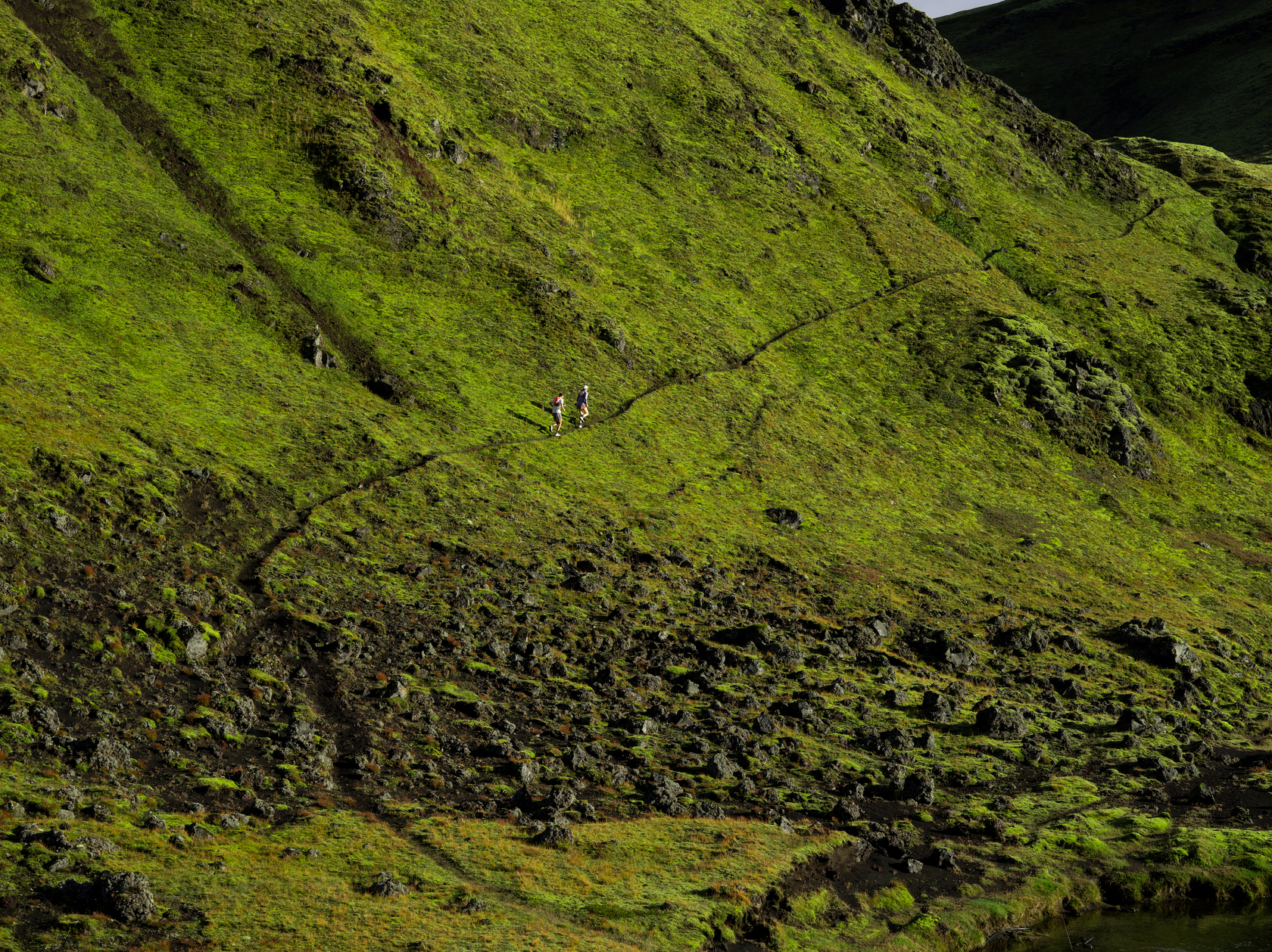
South Bruny National Park contains an appealing mix of towering dolerite cliffs, secluded coves, long sandy beaches, colourful heathlands fragrant dry and wet eucalypt forests, and borders a large lagoon.
Cradle Mt Day Walk Map & Notes
Situated in central western Tasmania, Cradle Mountain - Lake St Clair National Park is the most famous of Tasmania's national parks. Its rugged mountain peaks and alpine moorland offer some of the finest scenery in Australia, making it a mecca for bushwalkers.
This map highlights the walking tracks and features tourist information along with general topographic detail. The notes on the reverse side introduce visitors to the vegetation, land forms, animals, history of the area, bushwalking tips and safety essentials.
Cradle Mt Lake St Clair NP Map & Notes - WATERPROOF
A special edition of one of our most popular productions. This map is printed on JPP synthetic, a high - tech alternative to paper, which has extra strength, durability and water resistance.
Walkers in this park can expect rapid changes in weather at any time of the year, ranging from strong wind, sleet, snow or rain to blazing sun, so a reliable map is an essential companion for a safe journey.
This map highlights the walking tracks and features tourist information along with general topographic detail and is essential for walkers traversing the world famous Overland Track. The notes on the reverse side introduce visitors to the vegetation, land forms, animals, history of the area, bushwalking tips, safety essentials and booking requirements for the Overland Track.
Douglas Apsley NP Map & Notes
Situated between Bicheno and St Marys, Douglas-Apsley National Park is a place of rugged and wild beauty. Dramatic waterfalls, tranquil rockpools and the largest area of undisturbed dry sclerophyll forest in Tasmania await the visitor.
Frenchman's Cap Walk Map and Notes
The magnificent quartzite dome of Frenchmans Cap (1443m) is a mecca for bushwalkers and climbers. The panoramic view from the peak on a clear day includes Mt Ossa, features of the southern end of Cradle Mountain - Lake St Clair National Park and Macquarie Harbour to the west.
Freycinet NP Map & Notes
Freycinet National Park's spectacular red granite peaks, pristine sandy beaches, turquoise waters and stunning coastal views combine to make it one of Tasmania's most popular national parks.
Hartz Mountains Day Walk Map & Notes
Hartz Mountains was one of Tasmania's first popular bushwalking destinations. Today, visitors are still attracted to the area, much of which is now national park and preserved in Tasmania's Wilderness World Heritage Area - one of the last temperate wilderness areas in the world.
Highland Lakes Map & Angling Notes
This map replaces the previously published Central Tasmania map.
The Central Highlands of Tasmania are a rugged area with impressive scenery and world class trout fishing in the thousands of lakes and tarns located throughout the Highland Lakes region.
The map covers most of the plateau, it shows all of the lakes, how to get there along with launching facilities, accommodation, camping and caravan areas, fuel supplies and services.
The reverse side features updated, detailed notes and maps covering the prime fishing lakes. The notes are packed with valuable information on regulations, fish types and the best fishing locations and methods.
Lake St Clair Day Walk Map & Notes
Cradle Mountain-Lake St Clair National Park encompasses a wide range of rugged mountain scenery, glacial tarns, forest and alpine moorlands. At 167m Lake St Clair is the deepest lake in Australia.
This map highlights the walking tracks and features tourist information along with general topographic detail. The notes on the reverse side contain information on the walking tracks around the lake and nearby mountains, bushwalking tips and safety essentials.
Maria Island National Park Walk Map & Notes
Maria Island is a charming, peaceful and relaxing place where you can immerse yourself in the island's intriguing history, abundant wildlife, beautiful scenery and deserted beaches. Access to the island is by ferry from Triabunna.
Mount Anne: SW National Park Walk Map & Notes
Mount Anne is located in Southwest National Park within the Tasmanian Wilderness World Heritage Area. With an elevation of 1423m, Mount Anne is the highest peak in south west Tasmania and dominates the region around Lake Pedder. Mount Anne is a difficult walk but, for most, the views and experience are worth the effort.
The cover photo is by Becca Lunnon, winner of the “Your photo on your TASMAP” competition. Becca’s photo, Mount Anne from Lots Wife, was taken on what she described as a slightly ambitious solo day trip into Lots Wife, hampered by a recent snowfall.
Mount Field National Park Walk Map & Notes
Mount Field National Park is located 75 kilometres west of Hobart on the Maydena Road. Glacial valleys, tarns, spectacular waterfalls and abundant wildlife, all await the visitor.
Peninsula Walks incl Three Cape Walks - Walk Map & Details
Your guide to getting the most out of your Tasman Peninsula experience!
The Peninsula Walks map provides multiple map windows to provide maximum coverage while still folding to fit into your shirt pocket. This map will be an essential reference, whether you are going for a leisurely day walk or for a week-long adventure. The A3 format shows all Three Capes Tracks; Cape Pillar, Hauy and Raoul, as well as the Lime Bay State Reserve and other popular peninsula walks; including the Tasman Coastal Trail, Waterfall Bay, Tunnel Bay and Mount Brown.
This map highlights walk times, difficulty levels, public camping and facilities and features tourist information along with general topographic detail.
South Coast Walks Map & Notes
The Port Davey and South Coast tracks lie within the Tasmanian Wilderness World Heritage Area and are part of the Southwest National Park. There are no roads, no power lines and few modern conveniences The walks take the visitor to the southern extremity of an island at the world's end. This is wilderness.
Additionally bushwalkers should purchase the TASMAP Guidebook to Port Davey (includes Maps and Notes) TASM0040
Walls of Jerusalem Map & Notes
The Walls of Jerusalem are located in a remote area of the Tasmanian highlands. There is no road access into the park and entry is only possible by walking.
Wellington Park Recreation Map & Notes
Wellington Park is located in south-eastern Tasmania on the doorstep of Hobart. Dramatic cliff faces, boulder fields, waterfalls, amazing natural rock sculptures and panoramic views of Hobart and south-eastern Tasmania are just some of the things to be discovered within the park.

Tasmap National Park, Walk & Recreational Maps & Notes
OTHERS ALSO BOUGHT
-


 Up to 50% off
Find Your Feet
Find Your Feet Trail Running Micro Socks (Unisex)
In stockFrom $10.00$19.95Unit price /Unavailable -


 Up to 40% off
Icebreaker
Icebreaker Merino 150 Anatomica Boxers (Men's)
+1In stock$41.97$69.95Unit price /Unavailable -

Hanny Allston
Hanny Allston: The Trail Running Guidebook (Paperback)
In stock$24.95Unit price /Unavailable -


-


Find Your Feet
Find Your Feet Soft Bottles Wide Mouth 500mL
In stock$25.00Unit price /Unavailable -

-


-


Hanny Allston
Finding My Feet: My Story by Hanny Allston (Paperback)
In stock$36.95Unit price /Unavailable -