Tasmap 1:50000 Topographic/Cadastral Maps
Tasmap 1:50000 Topographic/Cadastral Maps - Adamsons is backordered and will ship as soon as it is back in stock.
Couldn't load pickup availability
Description
Description
The design of the 1:50000 Map Series provides a clear and accurate portrayal of topographic information, with symbols and map content giving enhanced depiction of buildings, hill shading and a simplified classification of vegetation.
The 1:50000 Series covers the entire State with 75 maps and is under active revision. Each map covers a 30 x 40 kilometre area with a 1 kilometre grid based on the Map Grid of Australia (MGA94). At this scale, 1 millimetre on the map represents 50 metres on the ground.
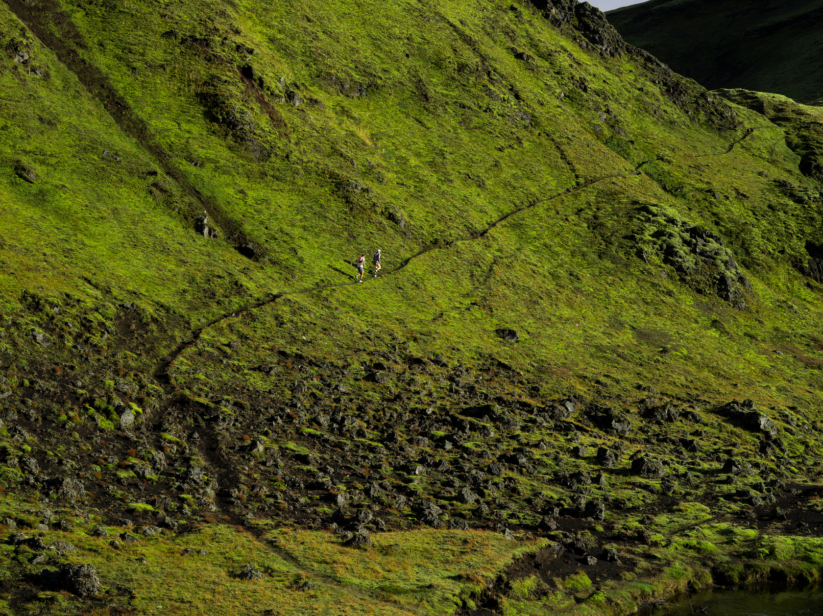
Adamsons
This map covers from the southern end of Hartz Mountains National Park to New River Lagoon and east to Southport. The western area is characterized by the rugged topography of the Southwest National Park. The map name is derived from Adamsons Peak (1225m), accessed by a tough day walk which gives the walker extensive views in good weather. The Moonlight Ridge track is generally used for access to multi day walks in South West National Park but also makes a great day walk just up to the ridge itself. The spectacular scenery continues on the way up to Pindars Peak (1250m) where the route to Precipitous Bluff (1145m) and New River Lagoon begins. There are numerous other attractions shown toward the coast including the stunning Hasting Caves, the historic Ida Bay railway and access to the beautiful Southport conservation area. The towns of Raminea, Strahblane, Southport and Lune River are covered.
The design of the 1:50000 Map Series provides a clear and accurate portrayal of topographic information, with symbols and map content giving enhanced depiction of buildings, hill shading and a simplified classification of vegetation.
Bathurst
This map covers the wilderness areas stretching from Federation Peak, Bathurst Harbour, Cox Bight to the Ironbound Range. An essential map for walkers using the South Coast Track and Port Davey Track to access Melaleuca.
Ben Lomond
This map covers the area dominated by the elevated mountain plateau and National Park bearing that name. Tasmania's second highest peak occurs on Ben Lomond, making the area exposed to wind and cold conditions with snow falls likely to occur at any time of the year. Whilst the plateau has winter ski slopes, the areas at lower elevations are dominated by production forest crisscrossed by a myriad of roads. This map is therefore an essential navigation aid.
Black Bluff
In the east of this map and commencing at Pencil Pine in the heart of Cradle Mountain country, the spectacular bushwalk known as the Penguin Cradle Trail ascends the Black Bluff Range to overlook the Vale of Belvoir. After descending to the River Leven, the trail negotiates the Leven Canyon then sidles the River north towards Gunns Plains. To the west, the map is predominantly a myriad of forestry roads amongst timber plantations, making this map an essential navigational aid.
The design of the 1:50000 Map Series provides a clear and accurate portrayal of topographic information, with symbols and map content giving enhanced depiction of buildings, hill shading and a simplified classification of vegetation.
Curries
This map covers from Beechford to Greens Beach and includes Lefroy, George Town and Low Head. Low Head, on the peninsula at the mouth of Port Dalrymple, is about 7 kilometres north of George Town and is a popular destination for snorkeling and scuba diving, with extensive wide unspoiled beaches. While there you can also do penguin tours and view the oldest continuously used pilot station in Australia.
The design of the 1:50000 Map Series provides clear and accurate portrayal of topographic information, with symbols and map content giving enhanced depiction of buildings, hill shading and a simplified classification of vegetation.
Denison Range
The map covers the remote, uninhabited area west of the Florentine Valley and the northern half of Lake Gordon. Most of the map area is Tasmanian Wilderness World Heritage Area where there are very few tracks. The Florentine Valley however is a labyrinth of production forest roads and for these reasons the map is an essential navigation aid.
Dohertys
The significant Dohertys Range, from where the name for this map comes, runs from north to south over this map. The western extents of Lake Gordon and Lake Pedder, both hydro lakes, are shown along with the imposing Gordon Dam, a National Engineering Landmark and the tallest dam in Tasmania at 140 metres high. A moderate but steep walk up Mount Sprent rewards bushwalkers with highly breathtaking views of the mountainous, isolated wilderness of the south west.
Eldon
The most prominent feature on this map is the small mining town of Queenstown, with its surrounding ‘moonscape’ appearance. This mountainous area was first explored in 1862, with alluvial gold being soon after discovered at Mount Lyell, prompting the formation of the Mount Lyell Gold Mining Company in 1881. The mountains surrounding Queenstown have unusual pink and grey hues caused by the conglomerate rock composition of the two most adjacent mountains. The locally named 99 bends, located on the Lyell Highway just out of Queenstown, is a favourite for Targa Drivers and tourists and takes in some rewarding scenery. To the east of Queenstown is Lake Burbury, a large Hydro lake formed by the building of two Hydro dams in the 1980s. The majority of the map is covered by the Franklin – Gordon Wild Rivers and Cradle Mountain – Lake St Clair national parks.
Fossey Mountains
The picturesque Mount Roland, occupying the central part of Fossey Mountains, is a popular day walk destination. The mountain range gives panoramic views over the town of Sheffield and its fertile agricultural plains to the north and the ravines carved by the Mersey River to the south. Extensive karst systems are a feature of the southern area around Mole Creek before the land rises steeply into the Great Western Tiers. The River Forth in the western part forms a chain of lakes used to generate electricity and divides the range. Lake Barrington is the venue for an internationally acclaimed rowing course.
Frenchmans
Frenchmans Cap (1446m) is the central feature of this map. The summit is a magnificent white quartzite dome and is the most prominent peak in the Franklin-Gordon Wild Rivers National Park. The 46km return walk is considerably more arduous than many other Tasmanian walks, passing through buttongrass plains, rainforest and spectacular glacial valleys to Lake Tahune, perched under the spectacular cliff face. Flowing 125 kms from its headwaters in the Cheyne Range to the Gordon River, the Franklin River is Tasmania’s most iconic wild river, renowned for its breathtaking scenery, energy and tranquility - experienced by rafting and kayaking enthusiasts. To the west is the Darwin Crater, believed to have formed over 800 000 years ago from a meteorite impact. The remnants of the once bustling port township of Pillinger at Kelly Basin are found at the termination of the former railway formation.
Hartz
This map covers the rural areas of Geeveston and Glen Huon and also depicts the access routes via the Picton and Huon Rivers to the wilderness areas of Tasmania's South West. An ideal map for rafters and explorers of the wilderness.
Jerusalem
This map is centred about the iconic and picturesque Walls of Jerusalem and includes the northern part of the national park bearing that name. The map also shows eastern approaches to Cradle Mountain Lake St Clair National Park via the River Forth and Mersey River. A significant part of the elevated Central Plateau Conservation Area is covered by the eastern half of this map which is an essential navigation aid for walkers and wilderness fishers.
King William
The majority of this map is situated in the Franklin – Gordon Wild Rivers National Park which includes dramatic mountain peaks, spectacular gorges, scenic rainforests and deep river valleys. Much of the landscape has been shaped by ancient glaciers and is remote and rugged. The terrain supports a diverse range of vegetation, from cool temperate rainforest, drier eucalypt forests and scenic button grass moorland. The King William Range and surrounding area hosts a number of short and extended scenic walks. The townships of Tarraleah and Wayatinah are noted for their camping grounds and nearby bushwalking, kayaking, mountain biking and fishing activities. Tarraleah is also home to a high altitude golf course.
Lake Pedder
The map covers the southern half of Lake Gordon and most of Lake Pedder, which are Tasmania’s largest artificial freshwater lakes and feed the hydro-electric Gordon Power Station. Lake Pedder is accessible for trout fishing, kayaking and swimming. Most of the map area falls in Southwest National Park which is part of the Tasmanian Wilderness World Heritage Area. Located in the west, the village of Strathgordon is set deep in the southwest wilderness on the shore of Lake Pedder. Mount Anne dominates the area, being the highest mountain in the southwest. The demanding high alpine circuit walk is for experienced walkers. An ideal map for fishers, walkers and explorers of this part of the southwest wilderness.
Lake Pieman
This map's central feature is the 50 kilometre long hydro lake bearing that name. The map covers an area of Tasmania¿s mining and mineral exploration belt and includes the towns of Rosebery and Zeehan. The area is popular with prospectors and people undertaking adventurous activities. Mt Heemskirk in the south west has historical significance in that it was named in recognition of the first European sighting in 1642 of what is now Tasmania.
Macquarie Harbour
Macquarie Harbour estuary dominates this map. It is surrounded by lush cool temperate rainforest, button grass moorlands, isolated beaches and bays which can only be accessed by boat or on foot. The Sarah Island Penal Station, regarded as one of the harshest in Australian colonies, was established in 1822. The entrance to the harbour was named “Hells Gates” by convicts, as it was the entrance to the hell of the penal station. The popular, historical West Coast Wilderness Railway travels between Queenstown and Strahan through breathtaking rain-forested hills, crossing many bridges over the King River. This map is essential for recreational activities such as boating, bushwalking and exploration.
Meander Valley
This map features the picturesque Meander Valley with its rolling agricultural land. The population centre of Deloraine is home to the annual Tasmanian Craft Fair which draws thousands of visitors and complements the local thriving arts industries, street sculptures and historic architecture. To the east, the classic Georgian village of Westbury bursts with old English charm from its stately inns, churches, homesteads, shops and public buildings. With numerous Regional Reserves and Conservation Areas to explore, this map is an essential navigational aid.
The design of the 1:50 000 Map Series will provide clear and accurate portrayal of topographic information, with symbols and map content giving enhanced depiction of buildings, hill shading and a simplified classification of vegetation.
Mount William
Mount William National Park is a pristine paradise tucked away on the north east coast of Tasmania. The windswept coastline features rocky outcrops marked with bright orange lichen and seemingly endless stretches of powder white sand that squeaks beneath your feet – all set against a backdrop of crystal clear turquoise water. The coastal heathlands of the park are home to the Xanthorrhoea plant; a skirt-like grass bush with a singular tall spike spire. A diverse array of terrestrial, freshwater, estuarine, coastal and marine habitats, each contain important flora and fauna species and ecosystems. Mount William National Park is perfect for walking, fishing, swimming or kicking back at your beachside campsite doing nothing at all. The park is home to an abundance of Tasmanian marsupials and, as you explore, you may spot kangaroos, wombats, wallabies or echidnas. wukalina/Mount William sits at 216m above sea level. From the summit enjoy panoramic views of the coast and, on a clear day, all the way to the Furneaux Islands in Bass Strait. The Musselroe Bay Conservation Area is popular with birdwatchers while the camping area offers a number of sites. The main attraction in the area is the Eddystone Lighthouse which is located 13 km north of Ansons Bay. The lighthouse was built from pink granite in 1889 and stands 42 metres above sea level.
Murchison
This map covers the internationally renowned Cradle Mountain walking area which includes the northern portion of the Overland Track. Prominent mountains include Barn Bluff, Pelion West and Tasmania’s highest peak Mount Ossa (1617m) and the map is an essential navigational aid for bushwalkers as this elevated area is subjected to harsh weather. The central part of the map shows a large tract of temperate wilderness consisting of rugged mountain peaks, deep valleys and large catchments including the Murchison and Sophia Rivers which feed into Lake Murchison and Lake Rosebery respectively. These lakes supply the Mackintosh Power Station and are also popular spots for trout fishing, kayaking and swimming. Mount Murchison attracts bushwalkers to a scenic comfortable day walk through rainforest followed by open alpine country offering breathtaking panoramic views.
Norfolk Range
This map is covered by regional reserves, conservation and nature recreation areas, a strong indication of its wild and untamed natural beauty. The landscape and vegetation has been shaped by exposure to the ferocity of the weather freely sweeping across the Southern Ocean to run aground on the west coast of Tasmania. Large plains have conditions on which only the toughest of shrubs survive, while trees shelter in the valleys. The aboriginal presence in this area is marked by the remains of shell middens, stone arrangements, rock engravings and shelters. Granville Harbour was first settled after World War 1 and is now the home of a $280 million dollar wind farm which came online in 2020. Visitors to this area can enjoy camping, fishing and bush walking.
Snowy Range
Snowy Range is the dominant topographic feature of the area. The range not only forms the boundary between the Huon Valley and Derwent Valley local government areas it also marks the transition from a production forest area to wilderness. To the east an extensive network of roads service the forest industry in the Huon and Plenty valleys. To the west lies the Tasmanian Wilderness WHA. The Styx valley to the north, once a production forest but now a substantial reserved area, contains some of the largest hardwood trees on the planet.
St Clair
This map covers the southern portions of Walls of Jerusalem National Park and Cradle Mountain Lake St Clair National Park. As this region is remote, elevated and exposed to highland weather events the map is an essential navigation aid for walkers and wilderness fisherman accessing the lakes west of Bronte Park.
Table Cape
Table Cape (177m) is the central feature of this map. The area is renowned for the annual flowering of tulips during spring and is home to the Table Cape Lighthouse, standing since 1888. The port city of Burnie dominates the south east corner. Proclaimed a city in 1988, Burnie has had a long history of heavy manufacturing, forestry and farming. This map is an essential navigation aid for the adventurous exploring the northwest coast, showing the large township of Wynyard, along with the coastal holiday spots of Boat Harbour Beach and Sisters Beach.
The 1:50 000 Map Series provides clear and accurate portrayal of topographic information, with symbols and map content giving enhanced depiction of buildings, hill shading and a simplified classification of vegetation.
Tasman Peninsula
The map covers the entire Tasman Peninsula. The Tasman National Park, renowned for its spectacular coastal scenery, diverse forests and newly opened Three Capes Experience, is a prominent feature of the area. Additionally, two Historic Sites at Port Arthur and Coal Mines, both inscribed on the World Heritage List as part of the Australian Convict Sites World Heritage are popular with visitors. The coastal conditions vary from huge waves for surfers to sheltered bays sought by recreational fishers and boat owners.
The Nut
This map features a wide range of environments in the far northwest of Tasmania. The northern portion of the map includes long sandy beaches, numerous bays and inlets. The fishing town of Stanley, with The Nut as a scenic background, and the regional centre of Smithton are shown. Smithton is supported by aquaculture, along with a range of local land produce including crop, dairy and beef farming and timber production, while Stanley is a hotspot for tourists. Additionally, the map area comprises of cool temperate rainforests and numerous significant rivers including Arthur, Black and Duck rivers.
Wellington
This map covers the greater Hobart area including the popular recreation areas of Wellington Range and Meehan Range. An ideal map for users wanting clear, accurate detail beyond the urban fringe of Hobart and an essential reference for emergency service organisations.
Western Arthur
The map is an essential navigation tool when traversing the wilderness areas south of Lake Pedder. Several important tracks giving access to the Western Arthur Range, the Eastern Arthur Range, Port Davey and the Huon are a feature of the map. The area may be subject to extreme weather including low visibility, wind, snow and storm at any time of the year.
Whyte River
This map features large tracts of temperate rainforest, being in the heart of takayna/Tarkine wilderness. The scenic area contains a number of tracks which attract bushwalkers and sightseers to its hilly terrain, rivers, streams and waterfalls, including the 40 metre high Philosopher Falls. The Savage River Mine is one of the states key mines, producing iron ore, while the town of Waratah supported a tin mine at Mount Bischoff during the late 19th/early 20th century and was Australia’s first town to have electric street lights. The town is now much smaller and has the unique feature of a waterfall in the town centre.

Tasmap 1:50000 Topographic/Cadastral Maps
OTHERS ALSO BOUGHT
-

 Up to 30% off
Salomon
Salomon Advanced Skin 12 Set Vest Pack (Unisex) Black
In stock$188.97$269.95Unit price /Unavailable -


 Up to 30% off
Icebreaker
Icebreaker Merino 150 Anatomica Boxers (Men's)
+1In stock$48.97$69.95Unit price /Unavailable -

 Up to 50% off
Find Your Feet
Find Your Feet Trail Running Mini Socks (Unisex)
In stock$10.00$19.95Unit price /Unavailable -


 Up to 50% off
Find Your Feet
Find Your Feet Trail Running Micro Socks (Unisex)
In stockFrom $10.00$19.95Unit price /Unavailable -
 Up to 30% off
 -

 Up to 30% off
Icebreaker
Icebreaker Apex Chute Neck Tube (Unisex)
Low stock$38.47$54.95Unit price /Unavailable -


 Up to 30% off
 -
 Up to 30% off
Icebreaker
Icebreaker Quantum Multisport Gloves (Unisex)
Low stock$41.99$59.99Unit price /Unavailable